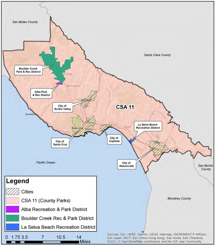
Service Area
The County Service Area 11 (CSA 11) jurisdictional boundary includes all of the unincorporated area of the County of Santa Cruz (area outside of city boundaries), excluding the three independent recreation districts. The independent recreation districts are Alba Recreation and Park District, Boulder Creek Recreation and Park District, and La Selva Beach Recreation District. CSA 11 covers approximately 444 square miles.
The service area's original sphere of influence was established in November 1985 and included the cities and independent recreation districts. A countywide sphere boundary was established in case one of the current park agencies decided to transfer service responsibilities to CSA 11. This was the case in 2022 when the Opal Cliffs Recreation District was dissolved. The dissolved area was annexed into CSA 11 and the service responsibilities were transferred over to the County.
Map of CSA 11
Projected Population
| Area |
2020 |
2025 |
2030 |
2035 |
2040 |
Average |
| County of Santa Cruz (unincorporated area) |
136,891 |
137,896 |
139,105 |
140,356 |
141,645 |
0.86% |
| Alba Park & Recreation District |
224 |
226 |
228 |
230 |
232 |
0.86% |
| Boulder Creek Park & Recreation District |
7,881 |
7,949 |
8,017 |
8,056 |
8,155 |
0.86% |
| La Selva Beach Recreation District |
1,641 |
1,655 |
1,669 |
1,683 |
1,698 |
0.86% |
| CSA 11 |
127,145 |
128,066 |
129,191 |
130,357 |
131,560 |
0.86% |
Source: Projected population data and CSA 11 vicinity map are derived from Santa Cruz LAFCO’s CSA 11 Municipal Service Review (Adopted Version, 2023) .